Introduction
A landslide is defined in general terms as the downward and outward movement of earth materials. Geologic materials and the type of movement involved were used to identify types of landslides in Nebraska. This website shows five types of landslides identified--using the Varnes Classification of Slope Movements--along Nebraska roadways.
Definitions
Descriptions, drawings and photography examples of five types of landslides in Nebraska.
Collection
A collections of landslides and related information. Searches can be based on County
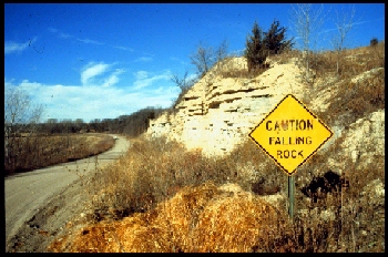
Falling Rock Sign, Thayer County, Nebraska. The road was developed in the Cretaceous-Greenhorn-Graneros formations. The road was temporarily closed by a landslide in the Spring of 1997.
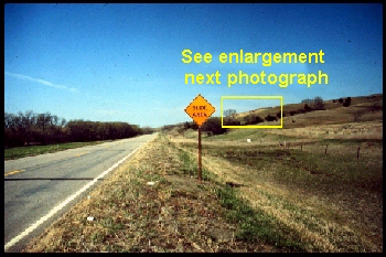
Slide Area Sign, East of Lynch, Nebraska, Highway 12, Boyd County. The next photograph is a close-up of the landslide in the yellow rectangle
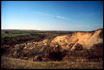
Highway 12, Boyd County, Nebraska. This landslide is a combination of an Earth Slump and Rock Slump. Pleistocene sand and gravels overlying Pierre Shale.
Contacts

This data is collected, administered, and provided by the Conservation and Survey Division.