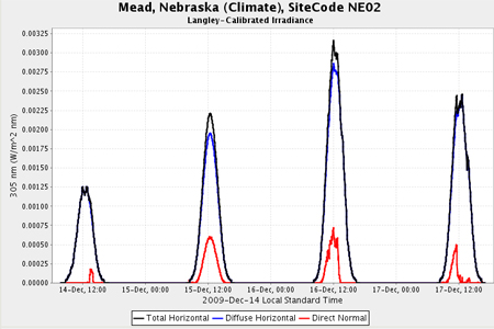
UV-B, Visible and NIR Radiation Data
We participate in the USDA UV-B Monitoring Program (a station at the Ag Meteorology Laboratory at Mead, NE), which provides temporal trends of ultraviolet -B (UV-B), visible and erythemal radiation and derived products such as UV daily sums, contour maps, UV index, ozone column and optical depths.

Automated Weather Data Network Maps - HPRCC
The AWDN maps show soil temperature, maximum temperature, minimum temperature, total precipitation, relative humidity, solar radiation, wind speed, and potential evapotranspiration for the past 1 or 7 days for the High Plains Region.
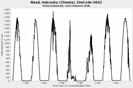
Photosynthetically Active Radiation (PAR)
We participate in the USDA UV-B Monitoring Program (a station at the Ag Meteorology Laboratory at Mead, NE) Photosynthetically Active Radiation (PAR) irradiance is an irradiance in Watts per square meter over the 400 to 700 nanometer spectral range. It is measured with a separate PAR pyranometer sensor.