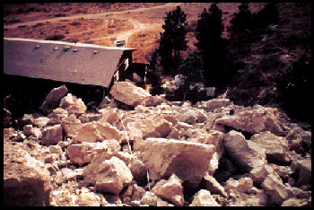
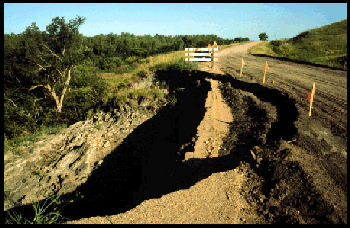
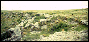
Rock Falls are defined as free falling rocks from a steep cliff or slope, along an undercut stream bank or an eroding valley wall. They occur mainly in the Greenhorn Limestone of Cretaceous age and in the Permian and Pennsylvanian aged rocks in eastern Nebraska and in the Arikaree, and Ogallala groups of Tertiary age in western Nebraska. Seventeen rockfalls were recorded in this study.
Source: Landslide Inventory Along Nebraska State-Federal Roadway System (MP-39), Section 2.2, by Duane A. Eversoll, CSD Research Geologist, 1991.
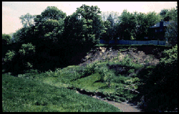
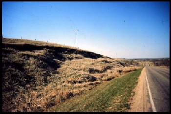
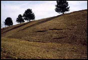
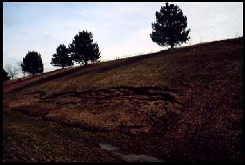
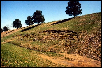
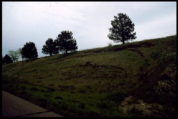
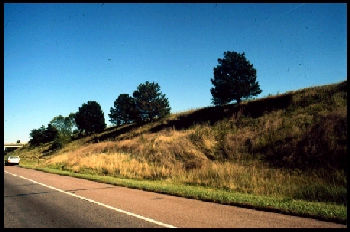
Earth Slumps are defined as non-bedrock deposits (loess, glacial materials, etc.) that move downward on a rotational failure plane. Of the 209 landslides inventoried, 108 were classified as earthslumps. Earthslumps are the most widespread and common type of landslide found in Nebraska. They develop mainly in loess and glacial deposits. One landslide was classified as a debris slump.
Source: Landslide Inventory Along Nebraska State-Federal Roadway System (MP-39, Section 2.4, by Duane A. Eversoll, CSD Research Geologist, 1991.
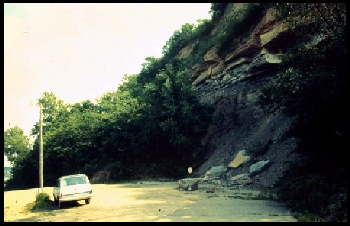
Rock Spreads are defined as blocks or slabs of bedrock that move laterally usually without a well-defined controlling basal shear surface or zone of plastic flow. Examples in Nebraska were observed along the south-central border and involved Cretaceous Greenhorn Limestone with lateral extension (movement) on the underlying Graneros Shale of Cretaceous age. Only one landslide was classified as a rockspread in this study.
Source: Landslide Inventory Along Nebraska State-Federal Roadway System (MP-39), Section 2.5, by Duane A. Eversoll, CSD Research Geologist, 1991.

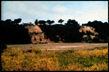
Rock Slumps are defined as a mass of bedrock that moves downward on a rotational failure plane. Seventy of the landslides inventoried for this study were classified as rockslumps. A majority of these rockslumps, occurred in the Pierre Shale of Cretaceous age.
Source: Landslide Inventory Along Nebraska State-Federal Roadway System (MP-39), Section 2.5, by Duane A. Eversoll, CSD Research Geologist, 1991.
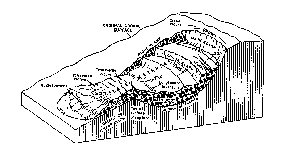
According to Varnes (1978) movement is by a combination of one or more of the principal types of landslides. Many landslides are complex, although one type of movement dominates over the other types in certain areas of a slide or at a particular time. Older and larger slides such as those observed along major river bluffs involving younger deposits overlying older bedrock were classified as complex. Thirteen landslides were classified as Complex.
Source: Landslide Inventory Along Nebraska State-Federal Roadway System (MP-39), Section 2.6, by Duane A. Eversoll, CSD Research Geologist, 1991.
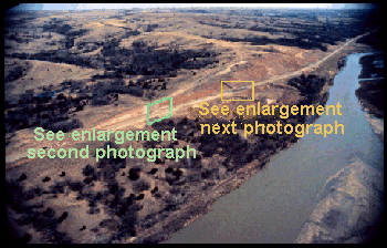
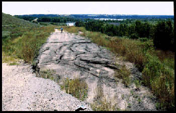
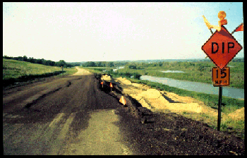
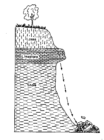
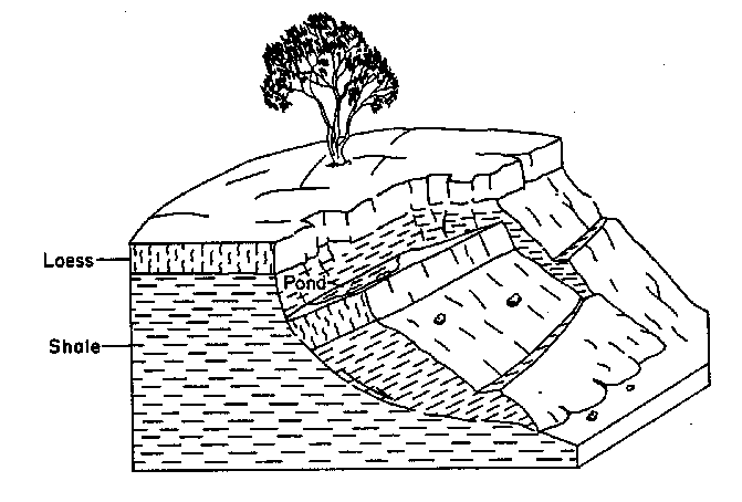
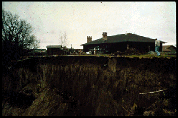
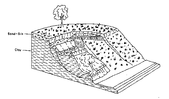
The Birth and Development of a Landslide Located Five Miles West of Lincoln on Interstate 80
Varnes Classification of Slope Movements, 1976
| Type of Movement | Type of Material | ||||
| Bedrock | Engineering Soils | ||||
| Predominately coarse | Predominately fine | ||||
| Falls | Rock fall | Debris fall | Earth fall | ||
| Topples | Rock topple | Debris topple | Earth Topple | ||
| Slides | Rotational Translational |
few units many units |
Rock slump | Debris slump | Earth slump |
| Rock block slide | Debris block slide | Earth block slide | |||
| Rock slide | Debris slide | Earth slide | |||
| Lateral Spreads | Rock spread | Debris spread | Earth spread | ||
| Flows | Rock flow (deep creep) | Debris flow (soil creep) | Earth flow | ||
| Complex | Combination of two or more principal types of movement | ||||