Shown below, there are a total 80 historical, black/white, photographs. They generally follow a chronological order, from the 1890s to the 1970s. When known, more specific dates are provided. The brief photo captions were based upon hand-written notes on the backs of the hardcopy photographs and/or recollections of Conservation and Survey Division employees. We hope you enjoy the photographs.
Set 1
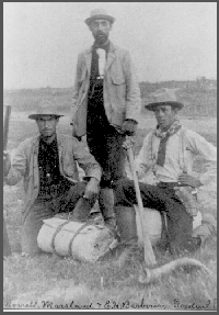
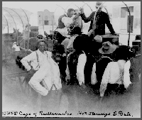
1894.C.H. Morrill, Marsland and E.H. Barbour.Cage of rattlesnakes. Hot Springs, South Dakota.Camp in the Pine Ridge, Nebraska.
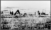
Camp scene.Camp scene.Stopped for repairs.Making repairs.Mammoth tusk on the Barney farm.Camp scene.
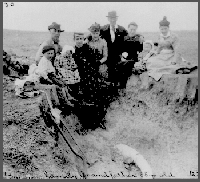
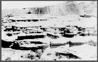
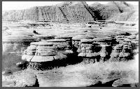
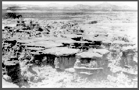
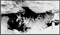
The Barney family; grandfather is 85 years old.Camp at Big Bad Lands.Barbour, Wortman and Gidley on "Metamynodon" Beds, 1894.Artesian well, approximately 1/2-mile west of Beaver Crossing, Nebraska.Toad Stool Park, Badlands, 1894.
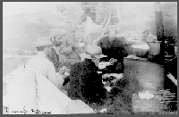
Toad Stool Park, Badlands, 1894.Toad Stool Park, Badlands, 1894.Camp in the Pine Ridge, Nebraska.Camp at rest, 1894.Camp at rest, 1894.
Set 2
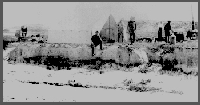
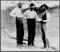
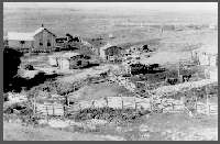
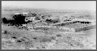
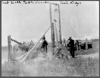
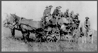
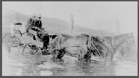
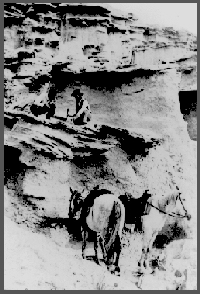
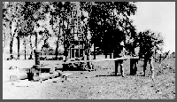
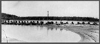
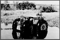
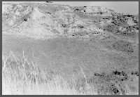
South McCormick Ranch; Typical South Dakota ranch, 1894.South McCormick Ranch, 1894.Deep well, Tablelands, Pine Ridge, Nebraska.The 1894 Morrill Expedition into the Bad Lands. Members of the expedition include: Ulysses Cornell; Harry Everett; Arthur Morrill; Jesse Rowe; Samuel McCormick, guide; E.H. Barbour, in charge; Edgar Morrill.Fording the Niobrara River.
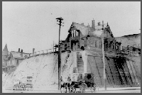
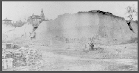
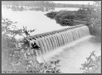
Lime kiln at Weeping Water, Nebraska.Loess at Omaha, Nebraska.Loess at Omaha, Nebraska.Loess at Omaha, Nebraska.Loess at Omaha, Nebraska.T.S. Johnson's mill dam near Milford, Nebraska.
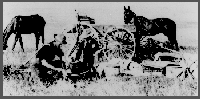
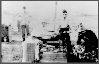
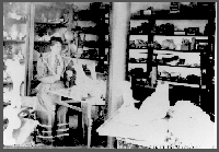
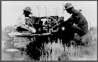
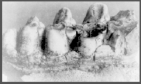
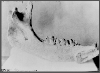
Carrie Barbour (sister of E.H. Barbour) working in lab, 1895.Camp at Sioux County, Nebraska.G.E. Condra, later director of the Conservation and Survey Division, takes a break with Barker and Pool from their Sand Hills field work, 1909.Molar of Mastodon.Rhino mandible.
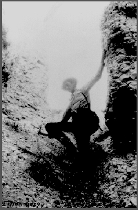
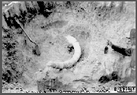
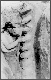
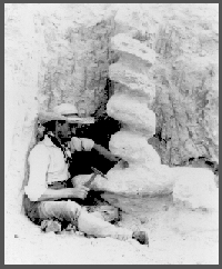
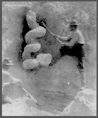
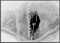
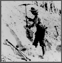
Seeing the limited materials on hand to teach geology, Erwin H. Barbour and assistant went into the field to look for fossil and mineral samples. They started in Sioux County, Nebraska, renting a covered wagon for transport. On their first day out, they found large corkscrew fossils that Barbour named "Daemonelix" (or Devil's Corkscrew). It was the first of many new fossils Barbour added to the pool of paleontological knowledge during his career.Marsland works on the "Daemonelix".Harris and Marsland work on the "Daemonelix" in the bluffs near Cook's Ranch.
Set 3
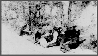
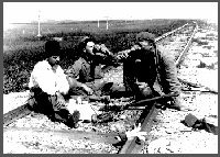
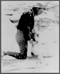
Messrs. Wortman and Gidley working on "Metamynodon" beds, probably in northwestern Nebraska, 1894. The face of the man on the left is partially obscured by a bandana, no doubt for protection from the dust. This photo was taken during the early days of the Nebraska Geological Survey, under the direction of E.H. Barbour, when the duties of the geological survey, the state museum and the geology department were combined in one organization.Removing titp. skull.J.P. Rowe works on titp. Skull, June 30, 1894.
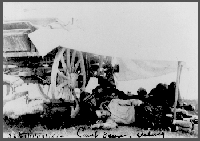
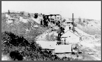
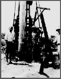
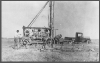
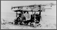
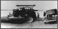
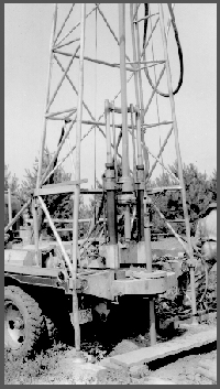
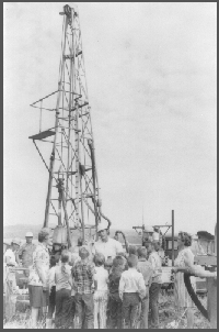
In the 1931 photo, A.L. Lugn (from left), Harry Burleigh and a man known only as Miller are using a retractor to retrieve a section of 3-inch pipe stuck in some gravel when the hole caved in. This shows a rear view of the new Dempster rotary-hydraulic rig. The rig had a wooden mast mounted on a trailer assembly. The Dempster cost $3,600 and was used for nine seasons.Miller (from left; first name unknown), Harry Burleigh and A.L. Lugn lower the screen and casing into the hole drilled by the Dempster rig, 1931.A rear view of the rig showing the jetting attachment to the 3"-pipe and the whirler just behind the chain on the pull-down rig. Miller and Burleigh work on the rig.A more distant view of the previous picture.
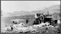
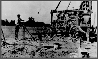
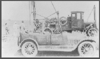
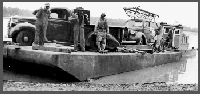
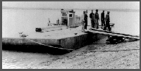
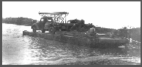
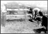
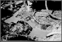
Harry Burleigh (left) is pumping water into one of the two nearby mud pits. Miller (first name unknown) stands beside the rotary-hydraulic Dempster rig that is drilling a 3-inch test hole. In the mud pit, clay is mixed with the water to form a mud solution. The mud solution is then taken from the pit by the rig's suction hose and pumped down the drill stem. The mud solution is deposited on the wall of the hole and acts as a casing to help prevent cave-ins, as well as bringing the samples to the surface. This return solution flows into the second mud pit, where the cuttings settle out. The wooden table in the foreground is used to lay out samples for close inspection and record-keeping. Picture was taken in 1931.Another view of the previous picture, 1931.Various vehicles used in the 1931 drilling project featured in the previous two photographs.The drill rig used in the above-mentioned 1931 drilling project.In the early 1940s, Nebraska City had water-quality problems because the city obtained its water directly from the Missouri River. Nebraska City hired Henningson Consulting Engineers of Omaha to find a suitable water supply for the city. Henningson contacted CSD for assistance in the drilling of test holes. Ellis Gordon (third from left), CSD, was sent to the proposed site. A barge was hired to transport the drilling equipment to a small island on the Missouri River. The salary of the geologist and head driller was $129.17 each per month.
Another photo from the Henningson Project, early 1940s.The Henningson Project, early 1940s.Backing the drill rig onto an island in the Missouri River during the Henningson Consulting investigations, early 1940s.Henningson Project, early 1940s.Charlie Keech stands by the new Holemaster Model drilling machine. Tools and operating equipment were purchased in July 1939 for $3,681 and the 1939 3/4-ton Ford cost $750, Summer 1941.August 1, 1941, near Cambridge, Nebraska. Charlie Keech operates the mud digger.
Set 4
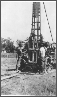
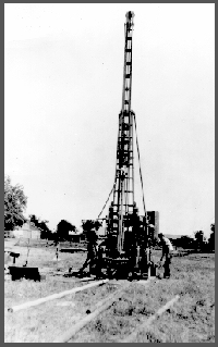
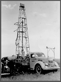
May 21, 1945. Failing Model "750" drill, on test hole 03-A-48, 3 miles north and 3 miles west of Raymond, Nebraska, 22-12N-5E, Lancaster County, Nebraska. V.H. Dreeszen, assistant geologist, at side of truck; James Nelson, driller, at drill controls.Rear view of the Failing Model "750".Failing "750" test drill setup on test 3-A-48, northwest of Raymond, Nebraska. Vince Dreeszen, on the right, is washing samples, 1948.Mud pits at test 4-B-49, southwest part of Lincoln, Nebraska, in Salt Creek Valley. Photo by E.D. Gordon, June 1949.
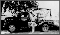
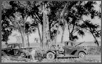
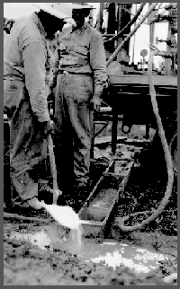
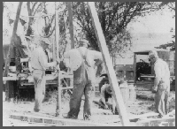
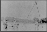
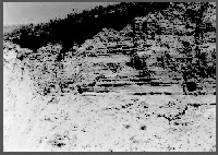
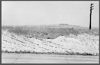
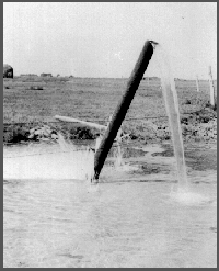
Ellis Gordon with shovel, adding lime to drilling "mud". In certain situations the lime causes the drilling mud to thicken which helps to move the cuttings to the surface.Probably a "marsh" or "swamp" buggy.Tripod set up to jet a well.A gin pole or tripod set up to cable tool a well or work over a well.May 20, 1948. Terrace deposits in north bank of tributary of South Loup River. Near center of 28-12N-15W, Buffalo County, Nebraska. The contact is marked by top of spade handle and head of the geology hammer.
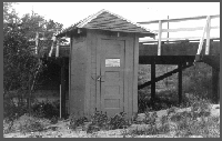
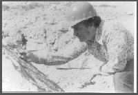
May 20, 1948.May 20, 1948. North-half of 28-12N-15W, Buffalo County, Nebraska. In north bluff of South Loup River. Note the dark soil zone.May 20, 1948.May 20, 1948. Terrace deposits on eroded older Pleistocene deposits in bank of a small tributary, at junction with South Loup River, near the center of 28-12N-15W, Buffalo County, Nebraska. Contact marked by top of spade handle and head of geology hammer.Shelter for stream gage.Roger Pabian examines a slab of late Pennsylvanian age limestone for marine invertebrate fossils around 1976.
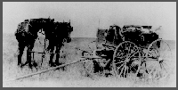
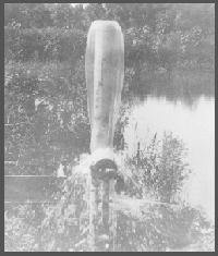
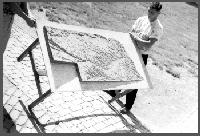
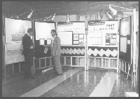
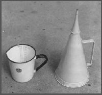
Artesian well, location is possibly near Fremont, Nebraska.Model of topographic map of Nebraska. Scale of map is 1:500,000.Vince Dreeszen and Charlie Keech, early 1950s.Jim Goeke explaining the techniques of test drilling to school children near Arthur, Nebraska in 1971. The driller is Gene Debus, his assistant is Bob Hansen.Marsh funnel; used to measure weight and viscosity of drilling "mud".