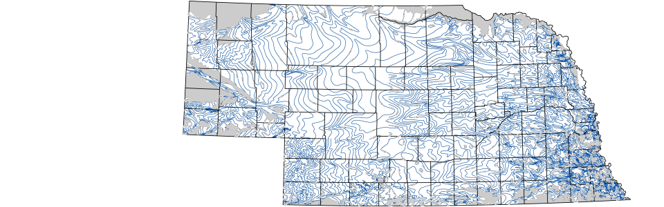
Configuration of the Base of the Principal Aquifer, 1979
The Configuration of the Base of the Principal Aquifer data consists of two separate layers: the contours layer (baseaq, which depicts the elevation of the base of the aquifer, and the polygons layer (absent), which depicts those areas where the principal aquifer is very thin, or absent. The GIS layer was developed by scanning the original, hand-drawn mylar quadrangles, converting the scanned contours into vectors and "tagging" each vector with the appropriate elevation. Similarly, the polygons depicting those areas where the principal aquifer is either very thin or absent were scanned and converted into polygons. Each of the individual quadrangles were then checked against the original maps for accuracy and appended to create a single, statewide layer.
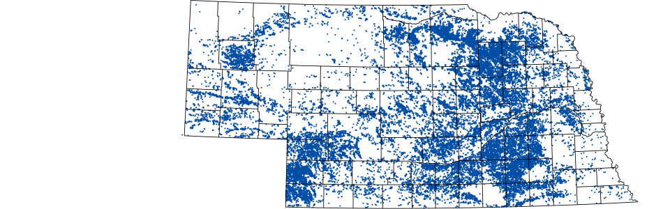
Center Pivot Irrigation Systems
Prepared from CSD Center Pivot Inventory data base. Data are derived from manually interpreted Landsat Thematic Mapper images. Each year pivots are identified and missing/abandoned pivots are noted. Features include: the legal description, years observed since 1972, Natural Resource District, and county. There are about 33,000 records (most recent year is 1988).