Analysis of Clay Illuviation Processes in Depressional Soils in the Todd Valley, Eastern Nebraska
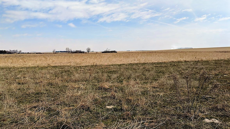
Closed depressions are a frequently encountered feature of the landscape in Nebraska. The five soil series associated with depressions in Nebraska (Lodgepole, Butler, Fillmore, Scott, and Massie) are estimated to cover 716,704 acres. These soils include vertic subgroups of Argiaquolls and Argialbolls. Understanding the soil formation processes in closed depressions is critical to management Nebraska’s wetland resources. However, the overlying imprint of multiple parent materials, human-accelerated erosion, clay illuviation, redox processes, and mixing by shrink-swell processes, make depressional soils extremely complex systems. This research will determine how soil properties indicative of clay illuviation vary within depressions of various size in the Todd valley. This information will enhance the science behind wetland restoration and management efforts in Nebraska.
Nebraska Dominant Soil Parent Material Mapping for the Soil Explorer Application
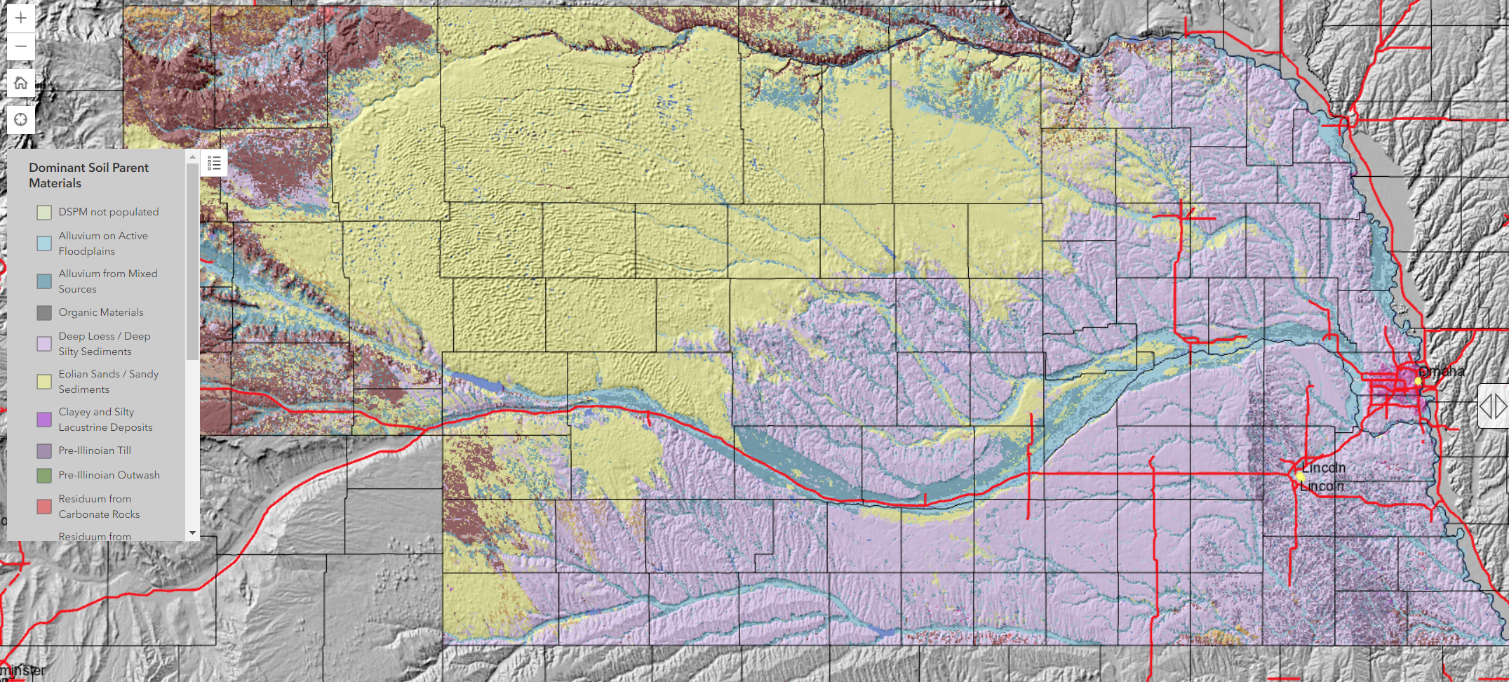
Click here to download a higher resolution graphic
Soil Explorer is a web application using data from the USDA Natural Resources Conservation Service soil surveys to display soils data in a format that engages students in thinking about the complex spatial relationship of soil properties. The Nebraska Dominant Soil Parent Material map in the application were developed by selecting the most important parent material for each soil series in the state (may soil series in Nebraska have more than one parent material). In the application, the Dominant Soil Parent Material map is overlaid with the shaded relief map, so that relationships between parent material and landforms are easy to discern. The Nebraska Soil Explorer maps can be view by selecting "North-Central DSPM Drafts" from the drop down menu at https://soilexplorer.net or in the iPad application.
Survey of Soil Scientists’ Methods for Determining Soil Texture in the Field
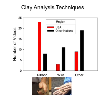
The determination of soil texture in the field is a critical skill for practicing soil scientists. The exact methods used to determine texture in the field are often highly individual and poorly documented. This study makes a survey on these techniques on the basis of instructional videos uploaded to the internet by soil scientist form around the world.
Click here to download a higher resolution document
Improving Student Accuracy at Determining Soil Texture in the Field
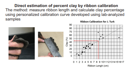
This study aims to develop new approaches to teaching students how to determine soil texture in the field. Major revisions to existing methodologies include: 1) basing clay estimates off of calibrated ribbon lengths, rather than standard cutoffs between texture classes and 20 estimating sand content on the basis of volume remaining when silt and clay are removed by washing. It is hypothesized that students will achieve greater accuracy with these methods and show greater improvement overtime in response to more informative feedback allowed by estimating of particle size fractions (rather than textural class alone).
Click here to download a higher resolution document