Introduction
Since April, 1979,we have maintained a formal agreement with the U.S. Geological Survey (USGS) designating the School of Natural Resources (SNR) as the USGS Earth Science Information Center (ESIC) for the state of Nebraska. ESIC serves as a clearinghouse for topographic, vegetation, soils and geological maps, historical and contemporary aerial photography and satellite imagery, soil surveys, National Wetlands Inventory data and many other types of digital cartographic data. Copies of all Nebraska topographic maps are stocked and sold to the public. Nebraska Maps and More, the SNR store, is pleased to serve as the outlet for Digital Raster Graphics, a revolutionary new map series recently completed for Nebraska.
What is a Digital Raster Graphic (DRG)?
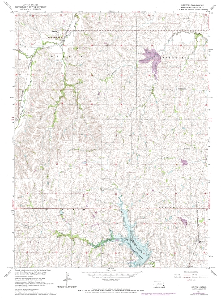
A digital raster graphic (DRG) is a scanned image of a USGS standard series topographic map, including all map collar information. The image inside the map neatline is georeferenced to the surface of the earth and fit to the Universal Transverse Mercator projection. The horizontal positional accuracy and datum of the DRG matches the accuracy and datum of the source map. The map is scanned at a minimum resolution of 250 dots per inch. The USGS is producing DRGs of the 1:250,000, 1:100,000, and 1:24,000-scale.
What is a DRG Used For?
A DRG can be used to collect, review, and revise digital data, and is especially well suited for use in a geographic information system (GIS). DRGs can be combined with other digital products, such as digital orthophoto quadrangles or digital elevation models to provide base cartographic information for GIS applications.
We Provide DRGs in Three Formats.
- Free downloading from this web site.
- Individual or selected quadrangles ordered on CD-ROM ($3.00 per quad plus $10 for media).
- Plots of individual quadrangles (nominal fee).
How Many DRGs are in Nebraska?
- 1:24,000 Scale: There are 1,571 DRGs
- 1:100,000 Scale: There are 57 DRGs
- 1:250,000 Scale: There are 18 DRGs
| Number of 1:24,000 DRGs by First Letter | |||||||
|---|---|---|---|---|---|---|---|
| A | 100 | H | 102 | O | 50 | V | 19 |
| B | 167 | I | 19 | P | 70 | W | 98 |
| C | 134 | J | 18 | Q | 3 | X | 0 |
| D | 70 | K | 30 | R | 65 | Y | 5 |
| E | 57 | L | 80 | S | 151 | Z | 0 |
| F | 32 | M | 122 | T | 56 | ||
| G | 61 | N | 46 | U | 16 | ||
Contacts

Matt Joeckel
SNR Senior Associate Director | Director, Conservation and Survey Division | Nebraska State Geologist
- rjoeckel3@unl.edu

This data is collected, administered, and provided by the Conservation and Survey Division.
