Posted: 12/2/2025
Drones debut in geospatial technology class
By Ronica Stromberg
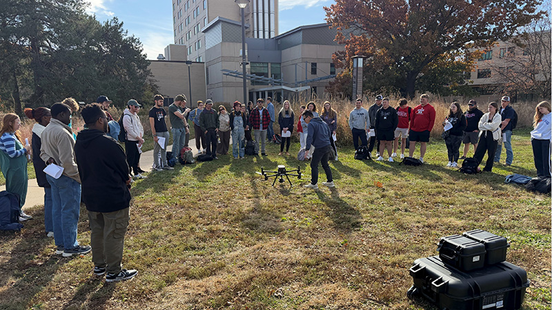
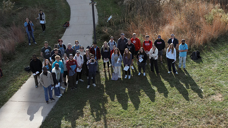
Ran Wang introduced drones into his spatial science courses this semester, and he and students found a new use for them, taking a selfie from the sky.
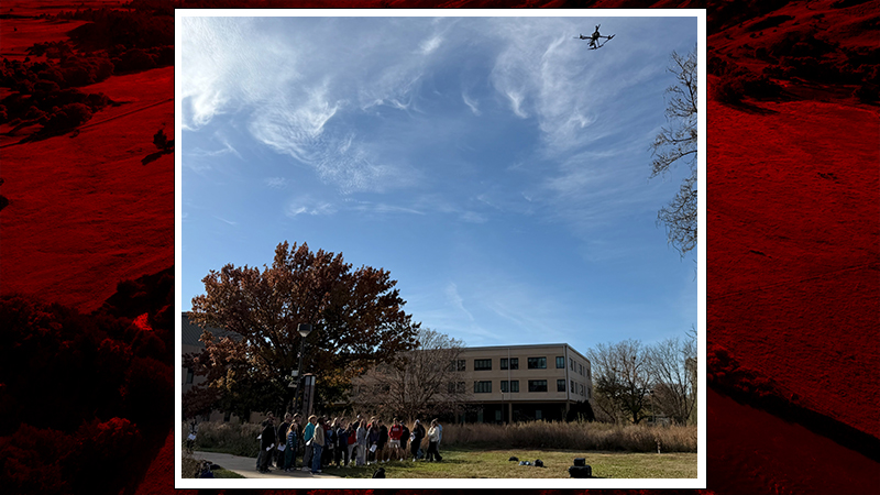
Wang, an assistant professor in the School of Natural Resources, and Biquan Zhao, a postdoctoral research associate in the Department of Animal Science, showed about 30 students from the Introduction to Geospatial Technology (NRES 218) class and the GIS for Agriculture and Natural Resources (NRES 415) class how to plan a flight on the monitor of a DJI drone. They then attached a high-resolution camera to the drone and collected image data—including themselves—from the backyard of Hardin Hall.
They attached a lidar sensor to a drone and showed the students how the drone monitor displayed trees and structures as holographs. Lidar sensors shoot lasers to the ground and the time it takes for lasers to reflect back allows the drone to measure the 3D structure of targets on the ground.
In follow-up classes, Zhao visited the introductory class to tell how he used drones for research in Nebraska grasslands, and in a lab exercise, students worked with the data the drone collected.
Edrine Mark Mayende, an agricultural engineer and graduate student, had worked with the Spidercam system at the Eastern Nebraska Research and Extension Center near Mead but said the drone instruction gave him a picture of the dynamics of drone operation for field data collection.
"It was an exciting experience seeing how exactly a drone is operated, right from assembly to launch to data collection and the safety precautions of operation," he said.
Before they are allowed to fly drones, the students will need to obtain the Remote Pilot Certificate awarded by the Federal Aviation Administration. Once certified, they can rent or borrow drones from the university.
Each university drone costs about $20,000, a price tag Wang said dissuades some students from touching them. Still, drones have become more popular in field research and have largely replaced airplanes for fine-scale mapping, he said.
"Students need to have these in their toolbox," he said.
Kelsie Hansen, a senior in environmental studies and sustainability, said she could already see uses for drones in her field.
"They can help me create maps, look into hard-to-reach areas, track changes in landscapes and help plan conservation zones," she said.
The quality of the image resolution in the drone demonstration had surprised her.
"They came by and showed us the live feed. The drone was high in the sky, and the camera feedback was so clear. I was shocked," she said.
Other students indicated in a follow-up class survey they were surprised to see that the drones flew autonomously, following flight plans rather than having a pilot directly control them.
Mayende said he was looking forward to developing research ideas using drone technology in agricultural operations.
"Being an agricultural engineer, there has been a great incorporation of drone technology in agricultural operations for precise decision making with minimal labor, and I am passionate about precision agriculture and drone technology," he said.
Wang said enrollment in the Introduction to Geospatial Technology class is growing fast, especially for students from agronomy, biological systems engineering, environmental science and wildlife studies. The class is offered in spring and fall and serves as a gateway to higher spatial science classes. In it, students use handheld GPS units in lab activities and learn about remote sensing instruments and satellites.
Wang said he hoped adding drones to the class would encourage more students to engage in the spatial science community on campus.