Remote Sensing Specialization in
Natural Resource Sciences Graduate Program
Only available to MS candidates.
Remote sensing refers to any technique whereby information about objects and the environment is obtained from a distance. The Remote Sensing specialization focuses on the collection and analysis of remotely sensed data acquired through sensors deployed
- at close range in the lab
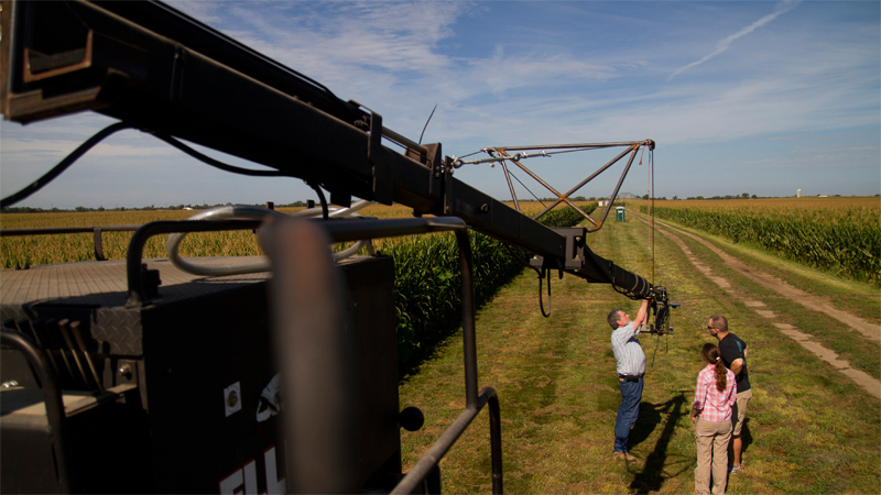
- operated in the field on various field vehicles and platforms
- from aircraft and satellites
Remotely sensed data can be applied across a range of spatial scales (e.g., site specific, landscape, or regionally/nationally) for many disciplinary areas.
Students specializing in remote sensing learn about the fundamental physical concepts of remote sensing, the many different types of sensors, how to process and analyze digital image data, and the various applications of this technology.
Faculty Point-of-Contact
If you are interested in the Remote Sensing graduate specialization, please feel free to contact the following SNR faculty member:
Required Courses:
- NRES 418/818 - Introduction to Remote Sensing (4 cr)
- NRES 420/820 - Applications of Remote Sensing in Agriculture and Natural Resources (4 cr)
- NRES 421/821 Field Techniques in Remote Sensing (3 cr)
- NRES 427/827 - Introduction to the Global Positioning System (GPS) (2 cr)
Elective Courses
Minimum of one course listed below and approved by the student’s advisory committee.
- NRES 412/812 Introduction to Geographic Information Systems (4 cr)
- GEOG 422/822 Advanced Techniques in Geographic Information Systems (4 cr)
- NRES 922 Seminar in Geographic Information Systems (3 cr)
Additional supportive courses in image processing, GIS, cartography and spatial statistics are also available through SNR and the departments of Earth and Atmospheric Sciences, Civil Engineering, Community and Regional Planning, Computer Science and Engineering, and Statistics.
Please see our admission requirements and application procedure pages for more information about our admission and application expectations for graduate degree candidates.
Government contractors and consulting firms frequently seek remote sensing specialists. Remote sensing is a very broadly based field.
Professionals with backgrounds in diverse areas that use information processed by remote sensing data:
- agriculture
- archaeology
- business
- ecology
- engineering
- forestry
- geography
- geology
- range management
- urban and regional planning
- water resources
- wetland ecology
- wildlife management
- manufacturing and machine vision
- meteorology
- oceanography
In addition, many remote sensing scientists are involved in basic research developing new sensor systems, other instruments, and defining new analytical techniques.